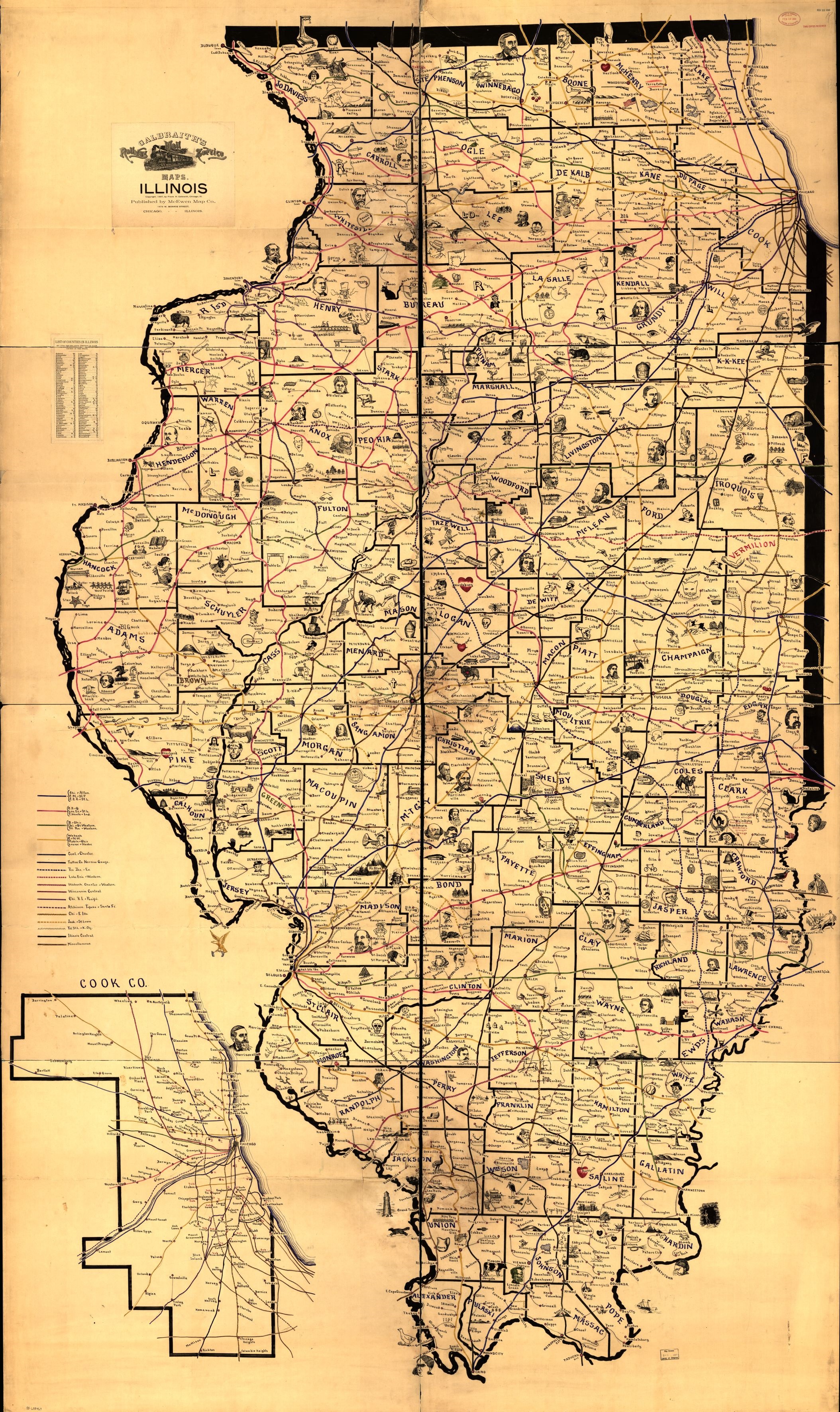
Maps
The border around an image below means you can view a larger image by clicking on the small image within the border.


- The Library of Congress has some Sanborn Fire Insurance Maps available for Carrollton, Greenfield, Roodhouse, and Whitehall
Some of the pdf files below are displayed sideways. You may want to right click on the image and choose a rotate option to adjust the display.
Some of the files below are not of maps, but instead provide information about landowners.
1861
- Miscellaneous 4-page pdf includes maps and references to Fayette, Greenfield, Homer, Kane, Whitehall, and Woodville, with building drawings and business listings
- Index 74-page pdf of business directories, cemeteries, creeks, lakes, and landowners
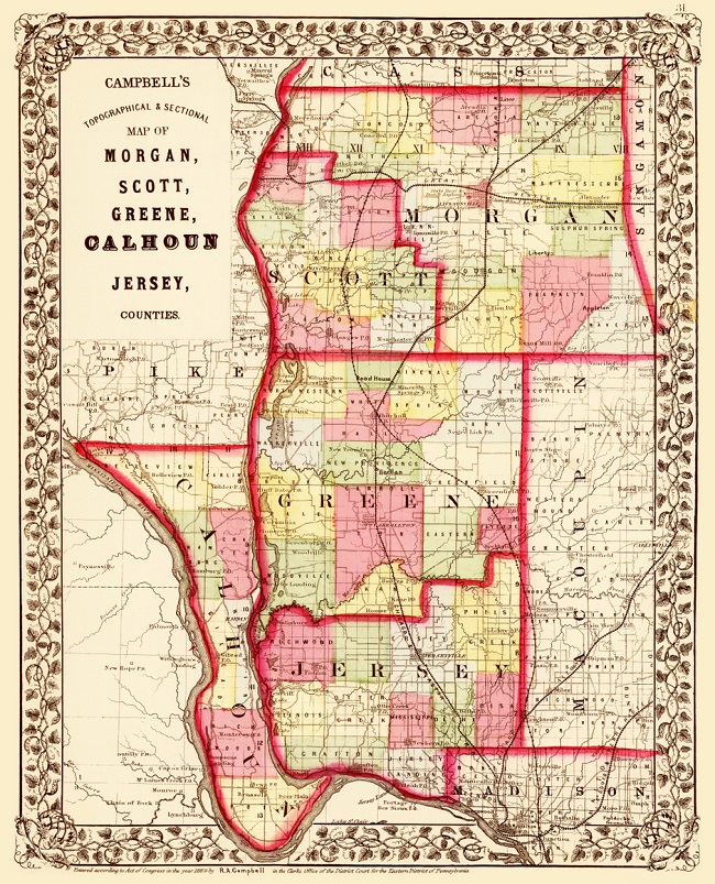
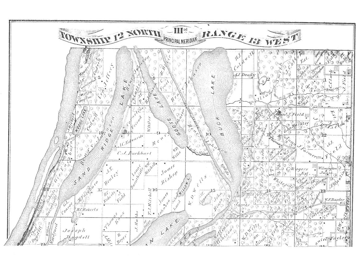
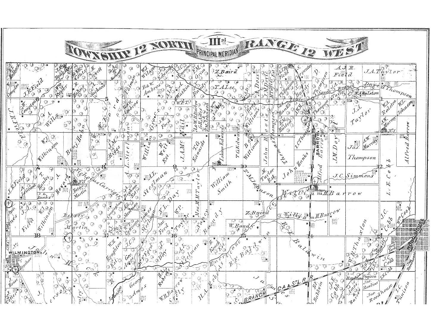
1873
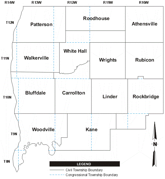
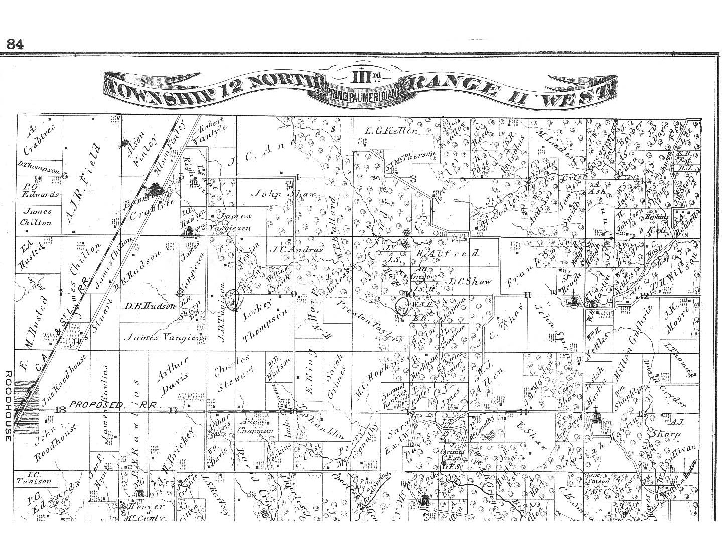
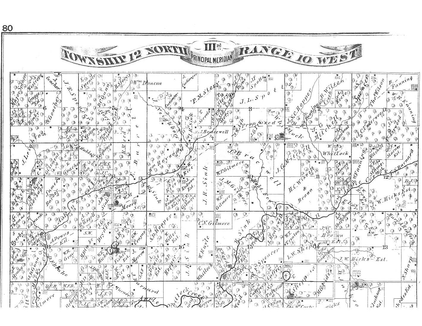
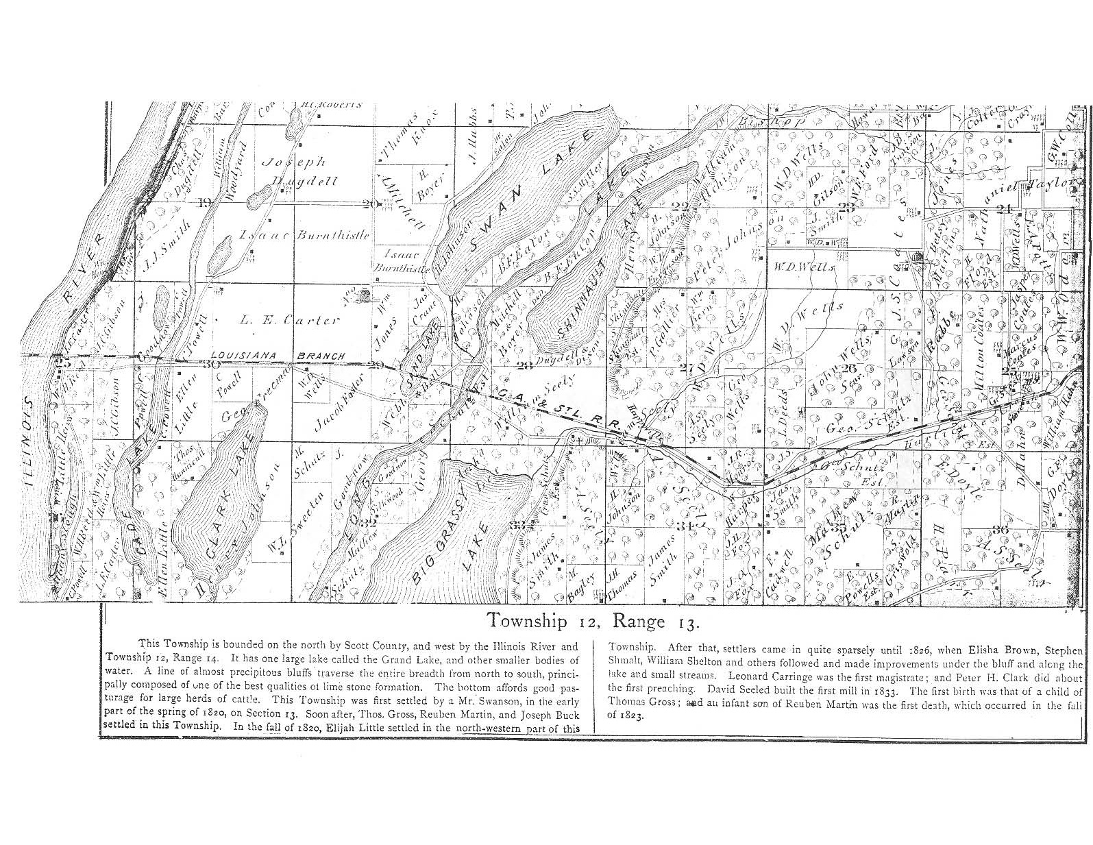
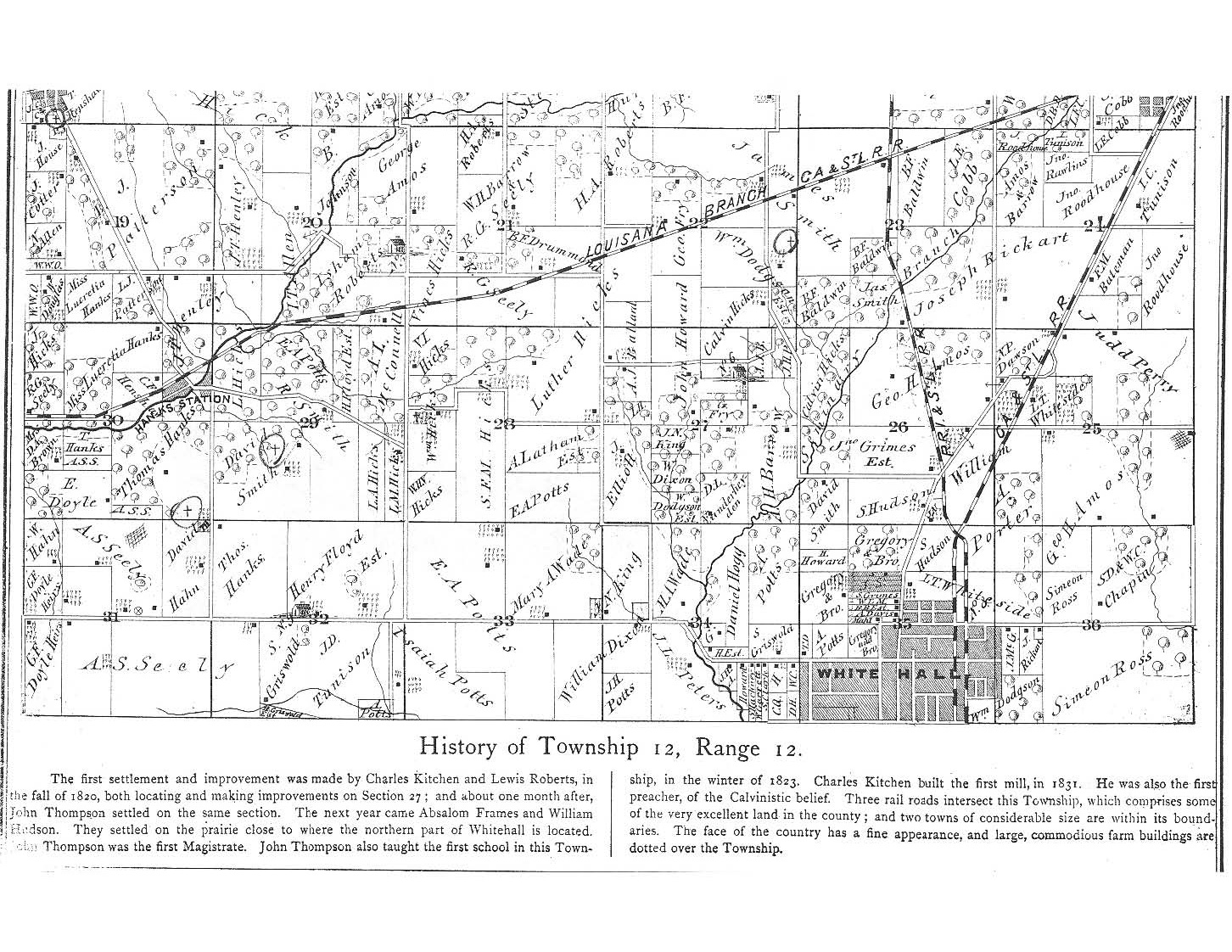
| Range 13 | Range 12 | Range 11 | Range 10 | |
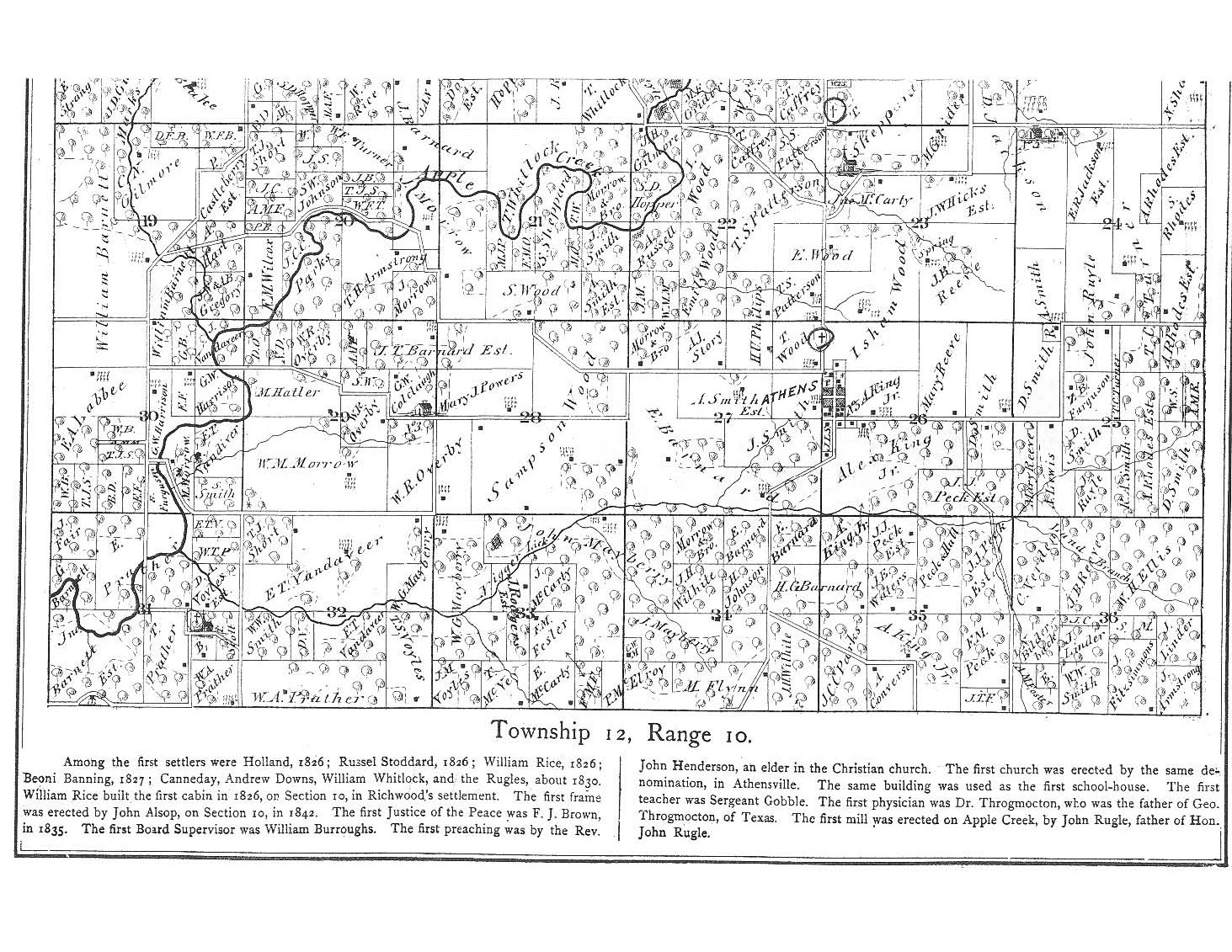
| Township 12 |
 |
 |
 |
 |
 |
 |
 |
 |
|
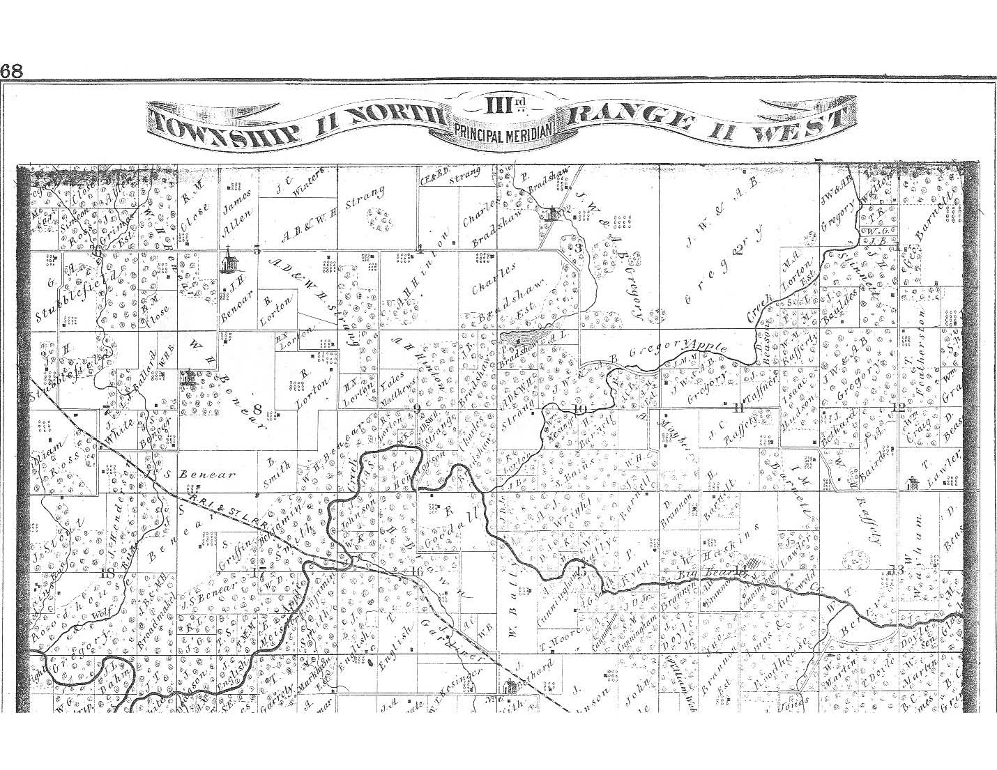
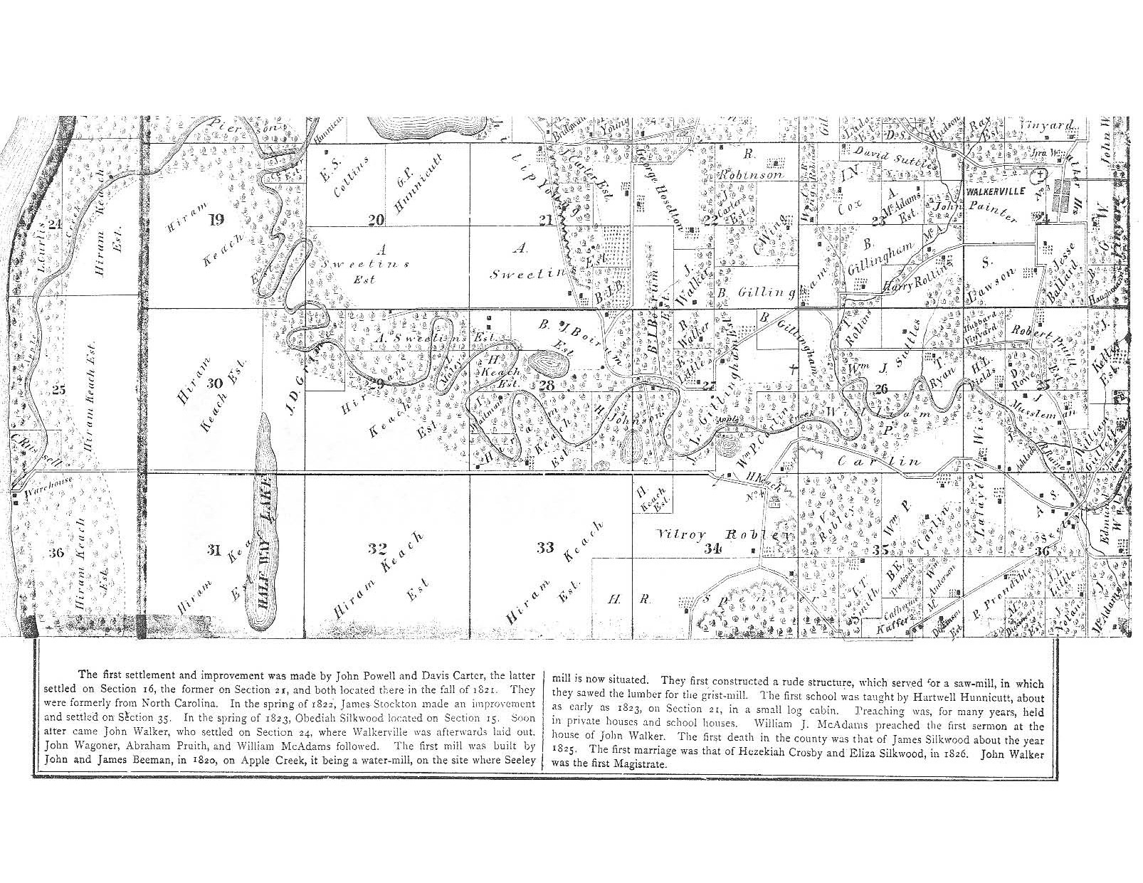
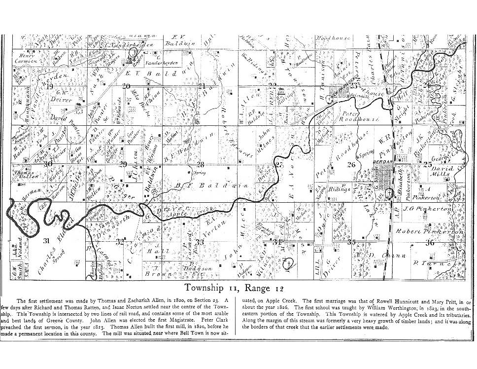
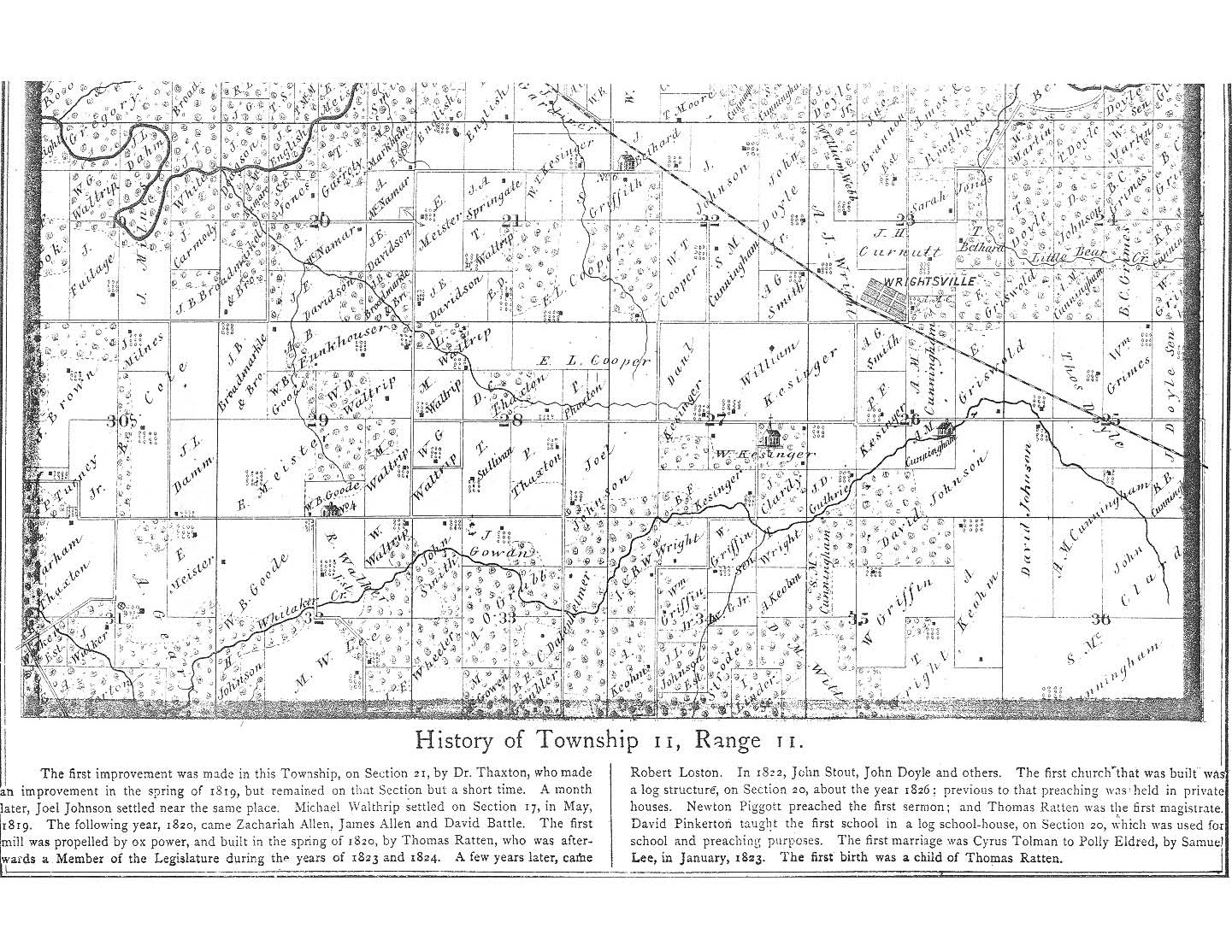
| Township 11 |
 |
 |
 |
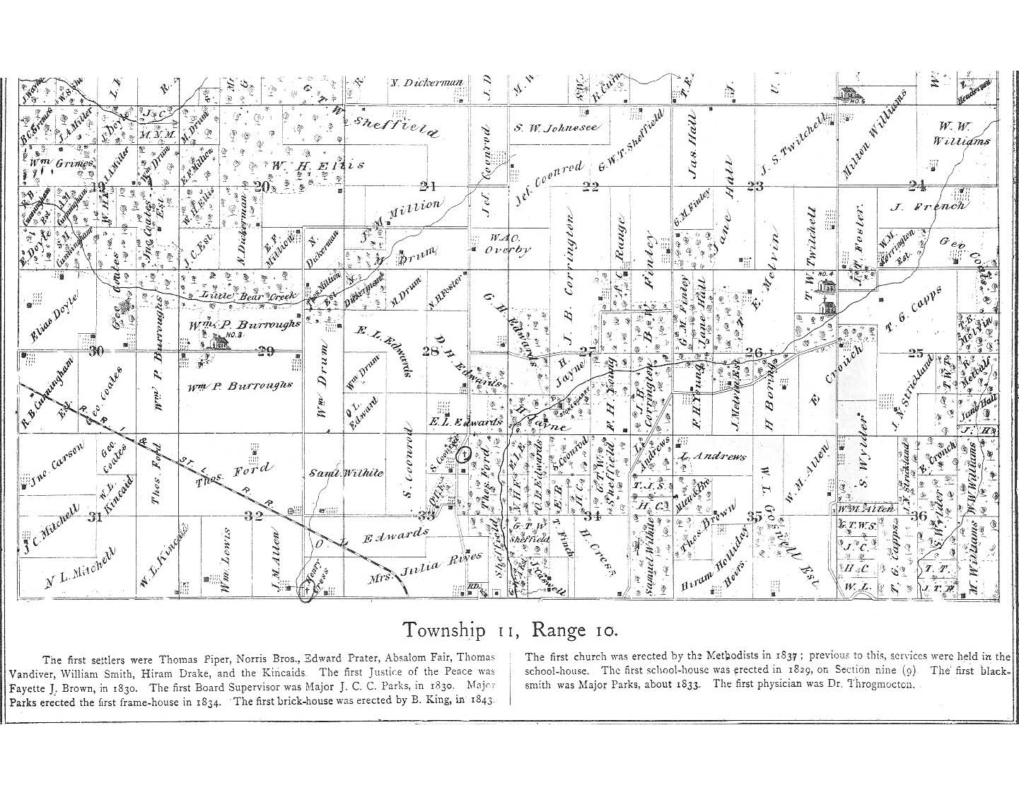
T11 R10 northern part link to pdf |
 |
 |
 |
 |
|
| Township 10 |
T10 R13 link to pdf |
T10 R12 link to pdf |
T10 R11 link to pdf |
T10 R10 link to pdf |
| T10 R13 link to pdf |
T10 R12 link to pdf |
T10 R11 link to pdf |
T10 R10 link to pdf |
|
| Township 9 |
T9 R13 northern part link to pdf |
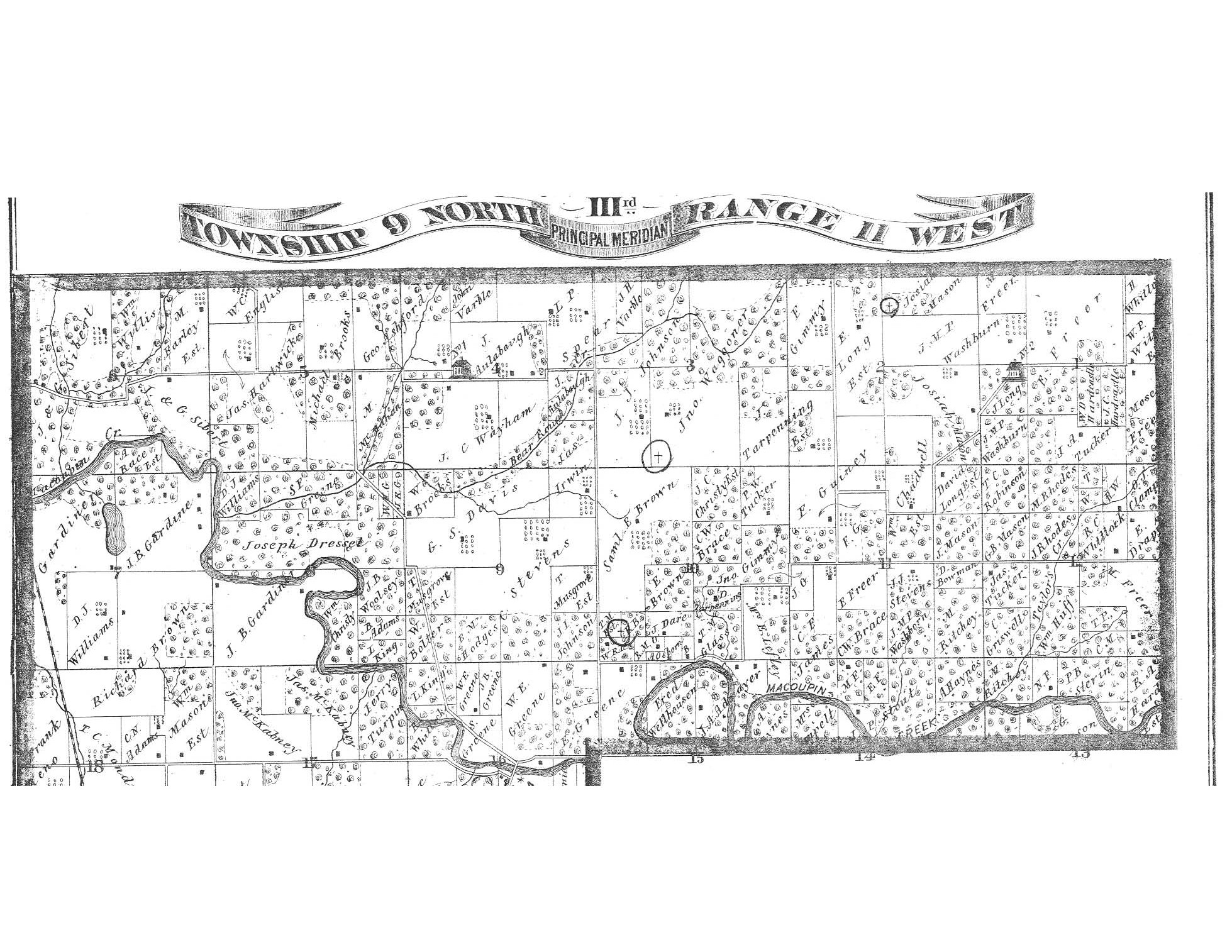
T9 R12 northern part link to pdf |
 |
|
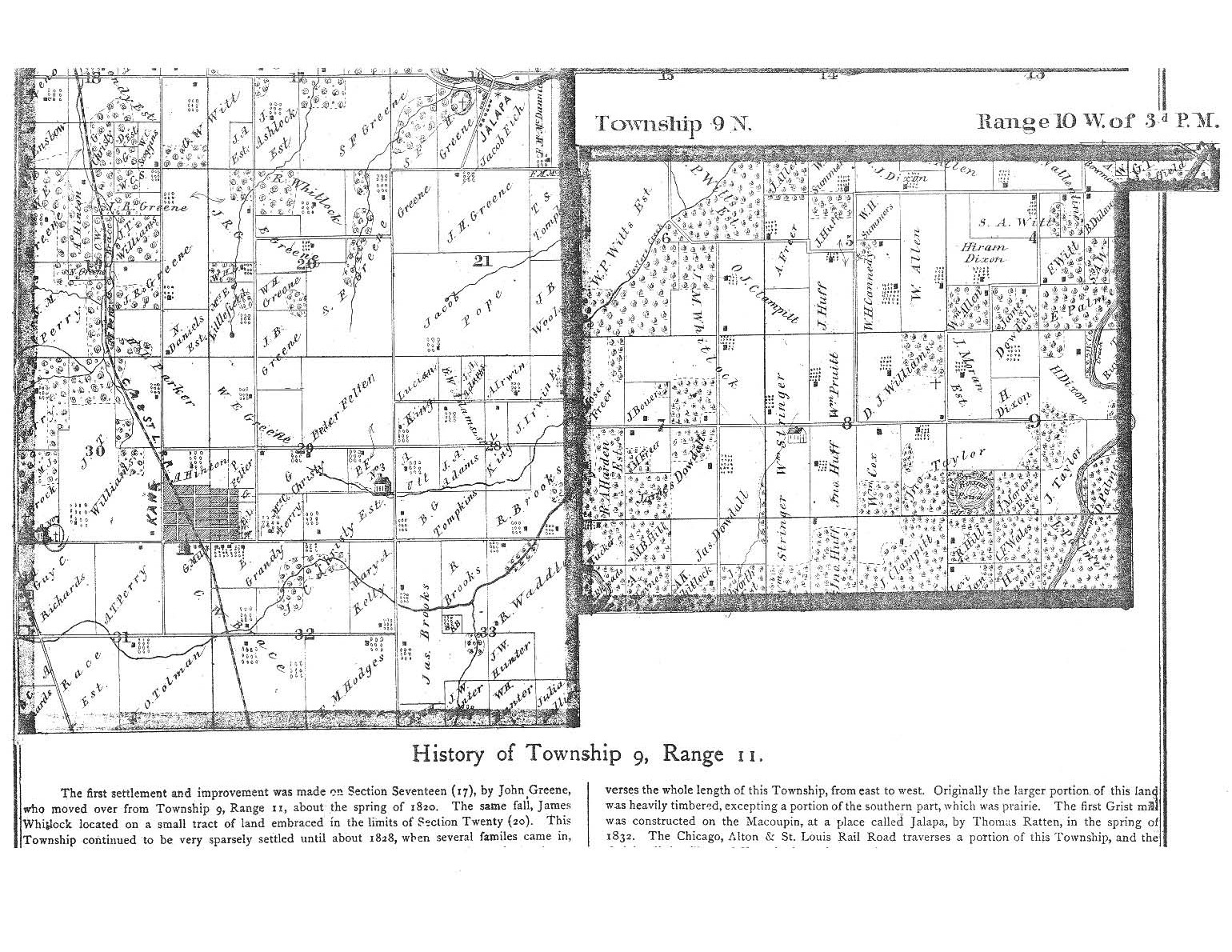
| T9 R13 southern part link to pdf |
T9 R12 southern part link to pdf |
 |
|
 |
 |
 |
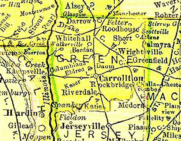
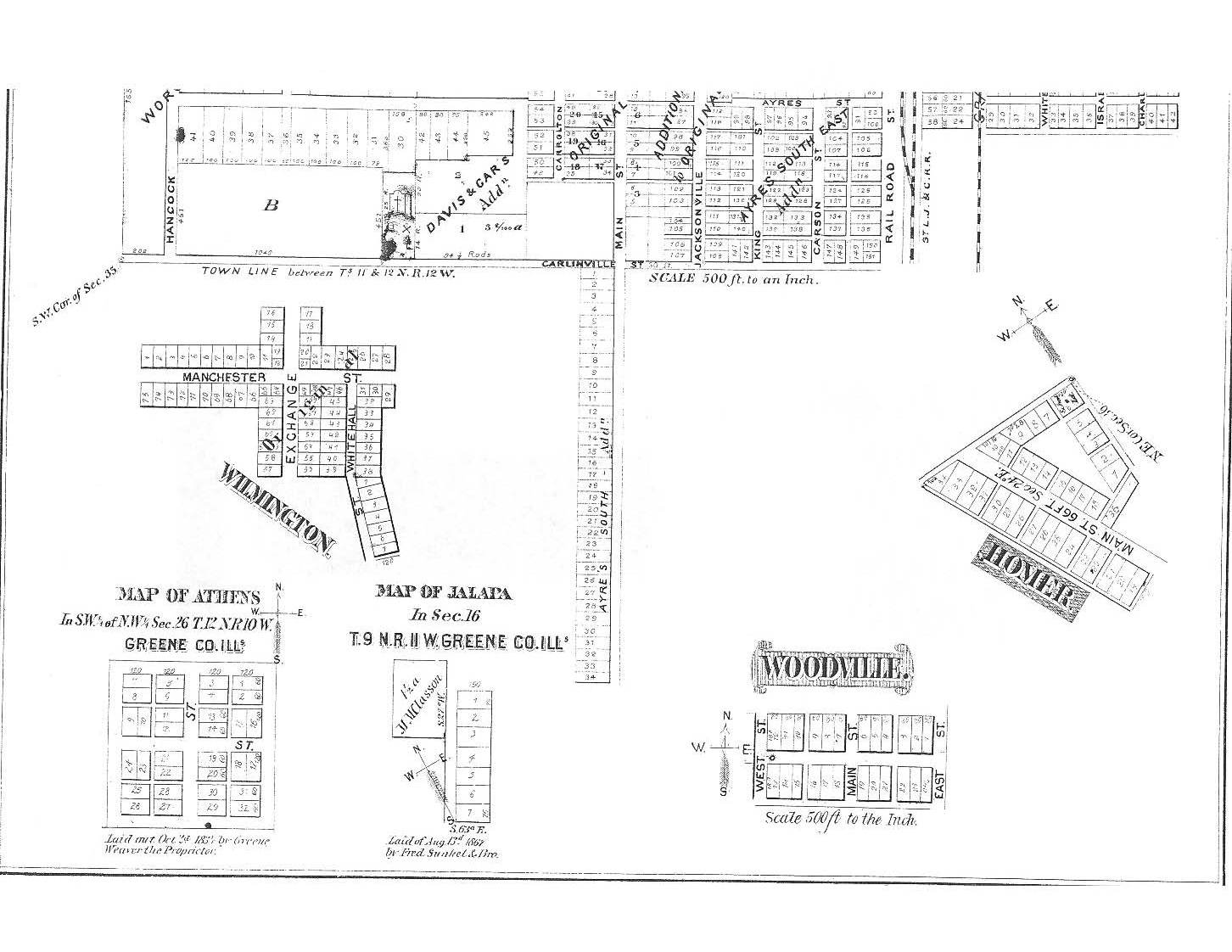
| Athens Homer Jalapa Wilmington Woodville |
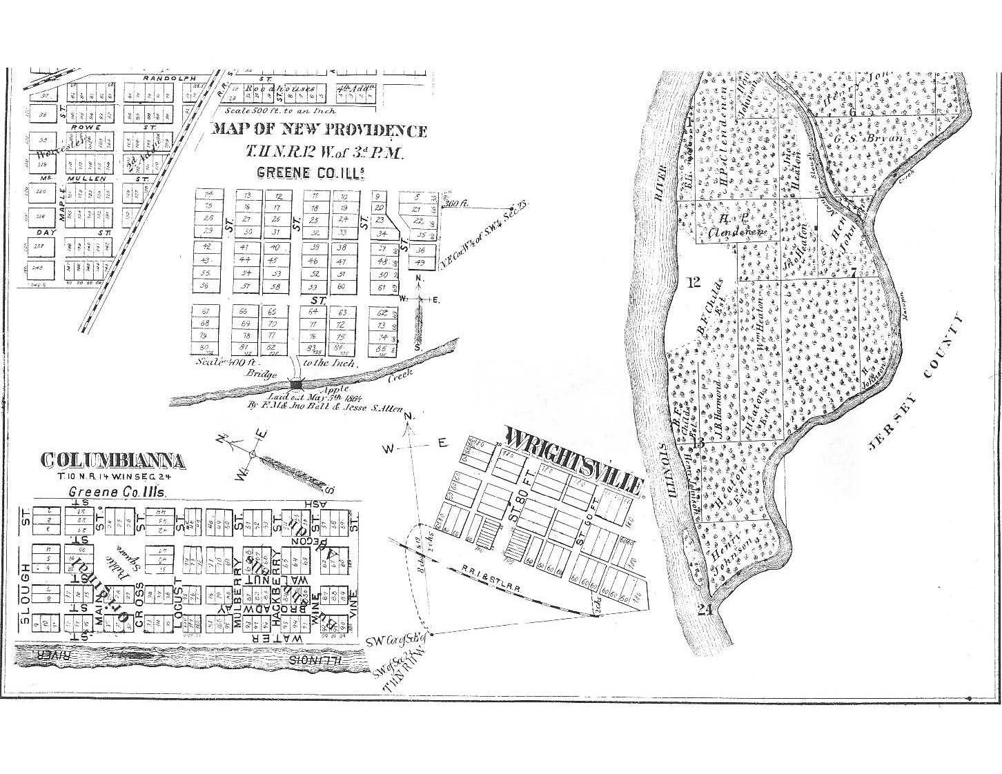
Columbianna NewProvidence Wrightsville |
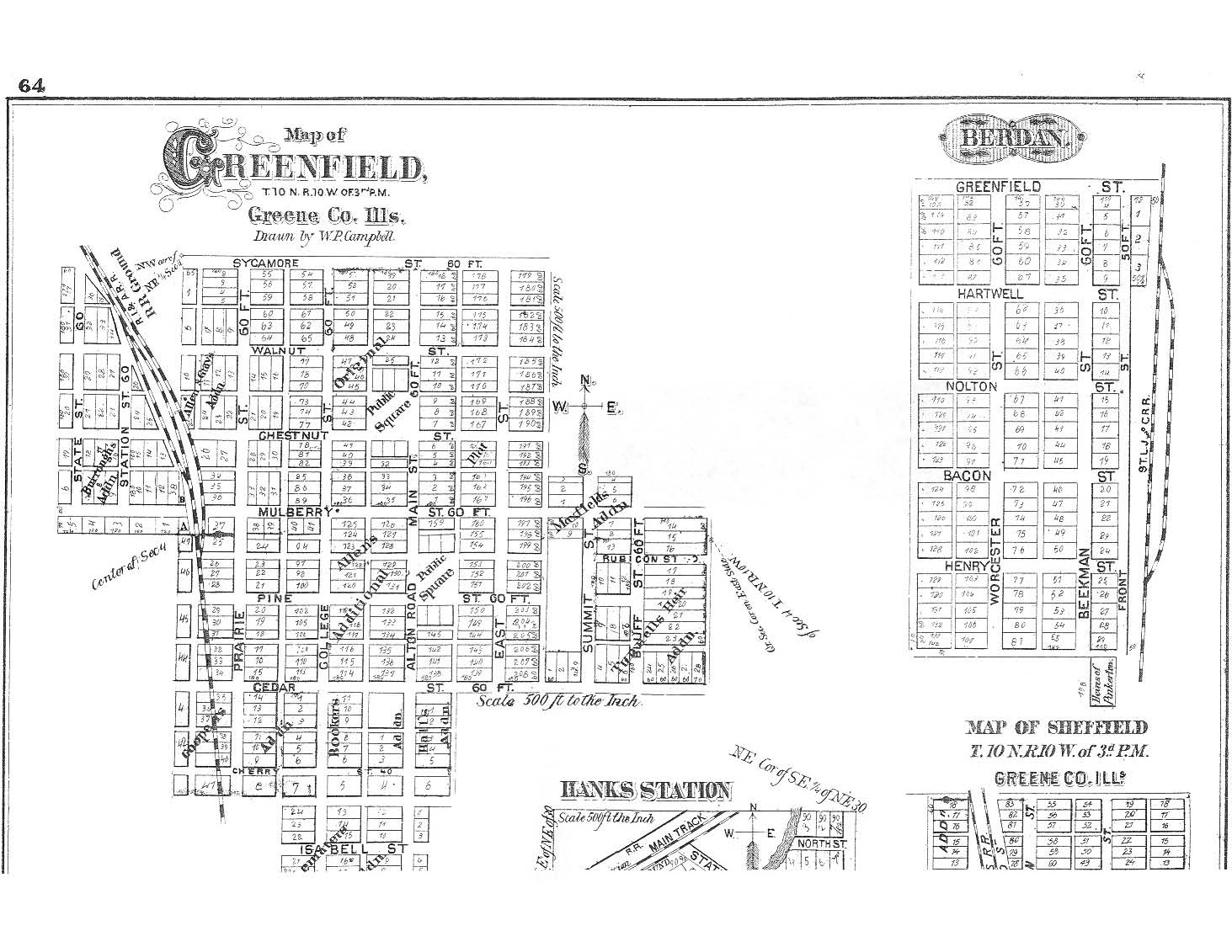
Berdan Greenfield Sheffield(top) |
 |
 |
 |
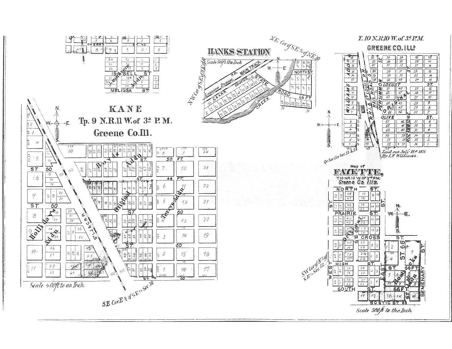
| Fayette HanksStation Kane Sheffield(botm) |
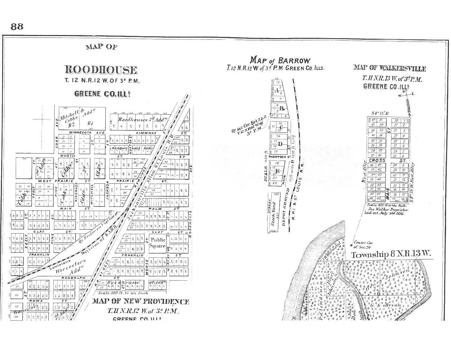
Barrow Roodhouse Walkerville |
Whitehall |
1915
- Athensville
- Barrow
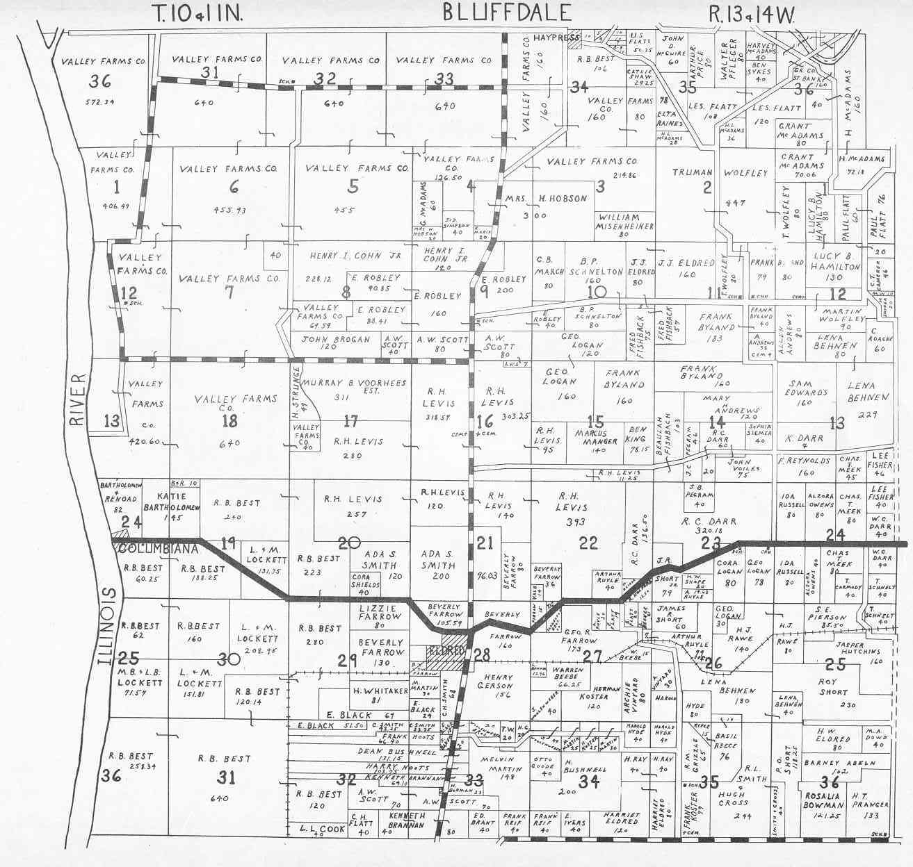
- Bluffdale Township
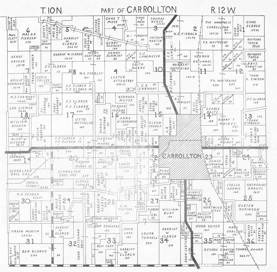
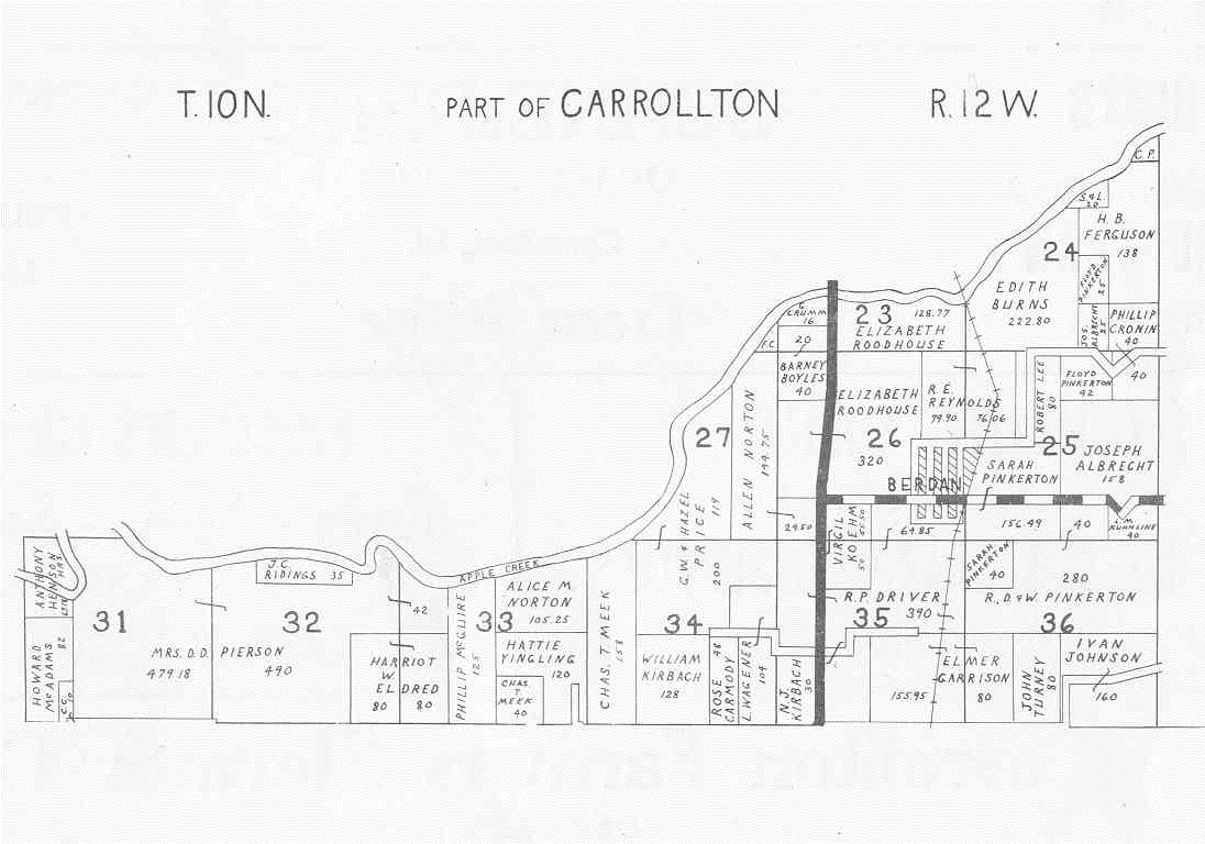
- Carrollton - Part 1
- Carrollton - Part 2
- Carrollton Township - Part 1
- Carrollton Township - Part 2
- Columbiana
- Drake
- Eldred
- Fayette
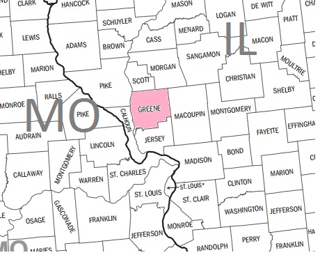
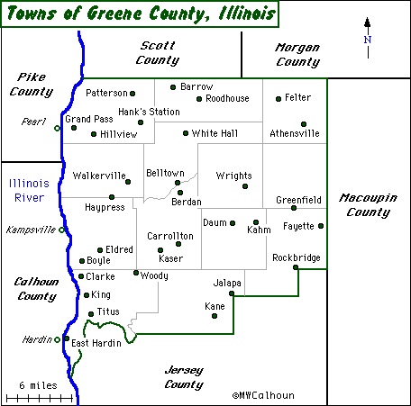
- Greene County
- Greenfield
- Haypress
- Hillview
- Homer
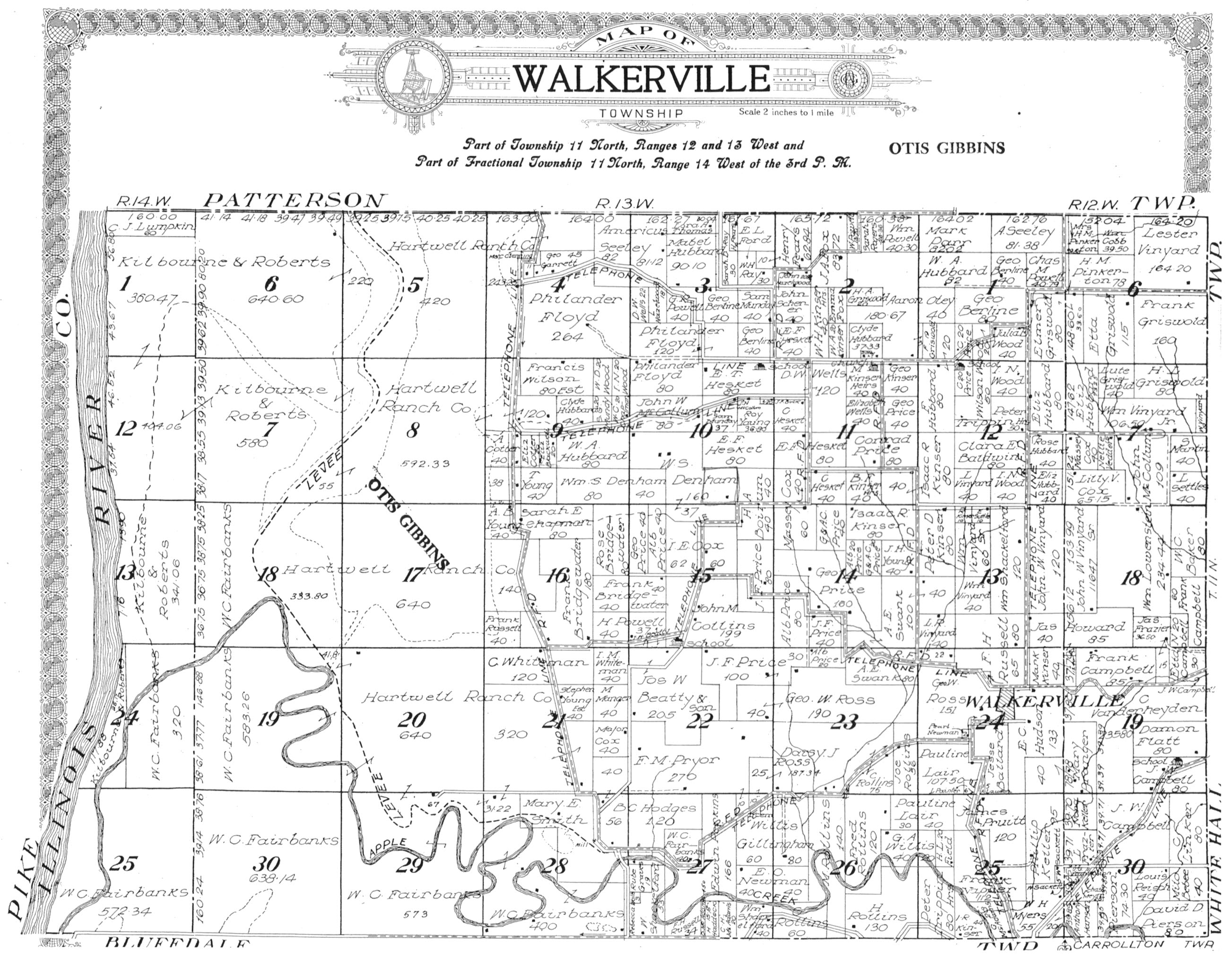
- Jalapa and Walkerville
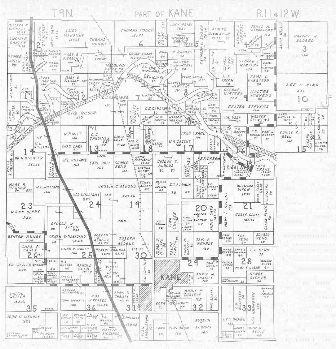
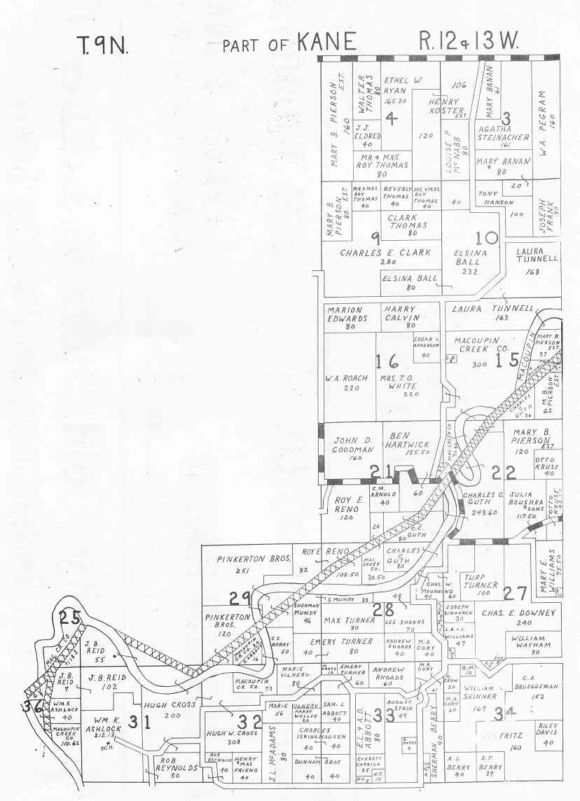
- Kane - Part 1
- Kane - Part 2
- Kane Township
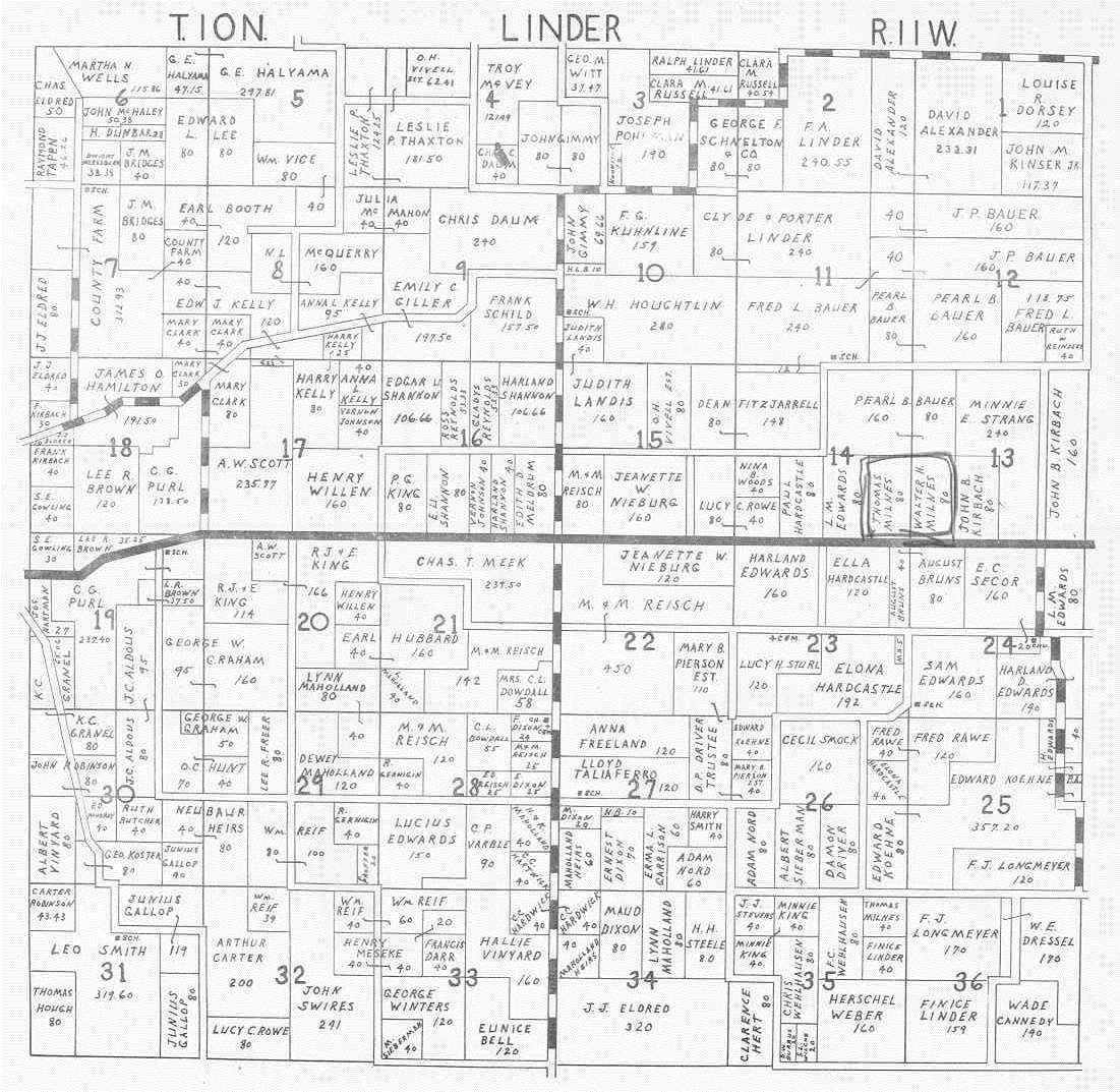
- Linder
- miscellaneous parts
- New Providence
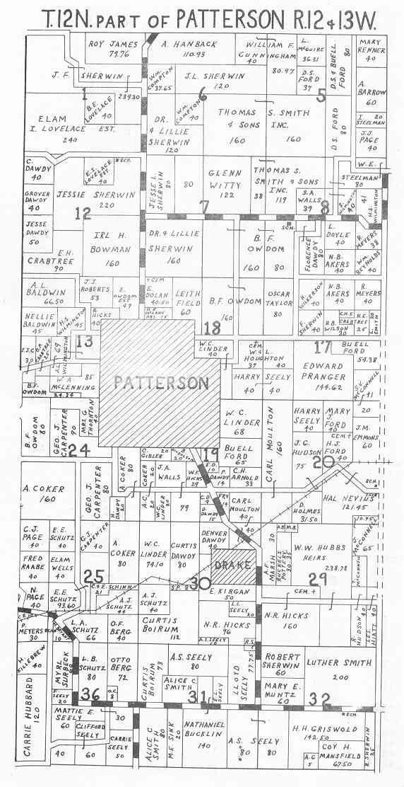
- Patterson
- Patterson Township
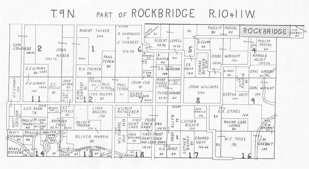
- Rockbridge
- Rockbridge Township - Part 1
- Rockbridge Township - Part 2
- Roodhouse
- Roodhouse Township - Part 1
- Roodhouse Township - Part 2
- Rubicon
- Walkerville Township
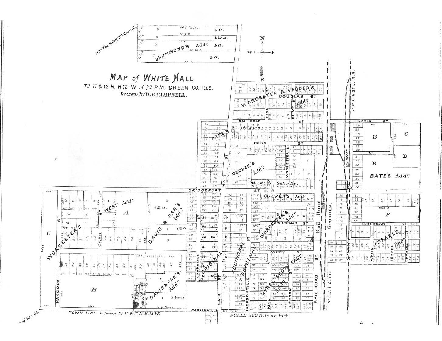
- Whitehall - Part 1
- Whitehall - Part 2
- Woodville Township - Part 1
- Woodville Township - Part 2
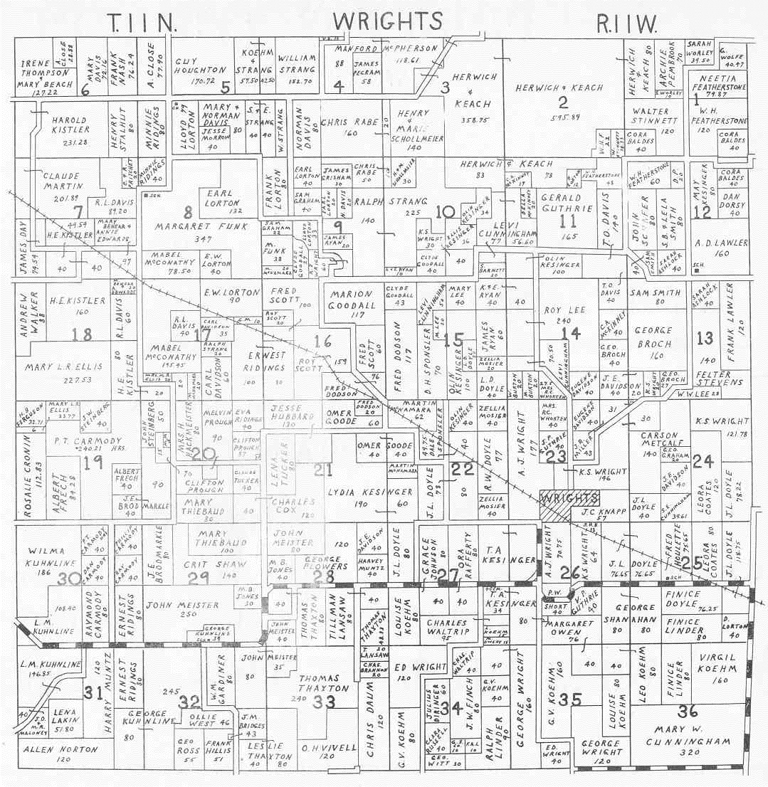
- Wrights
1946
 |
Athensville | |
 |
Bluffdale | |
 |
Carrollton - Part I | |
 |
Carrollton - Part II | |
 |
Kane - Part I | |
 |
Kane - Part II | |
 |
Linder | |
 |
Patterson - Part I | |
 |
Patterson - Part II | |
 |
Rockbridge - Part I | |
 |
Rockbridge - Part II | |
 |
Roodhouse - Part I | |
 |
Roodhouse - Part II | |
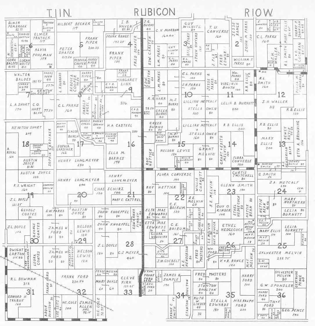 |
Rubicon | |
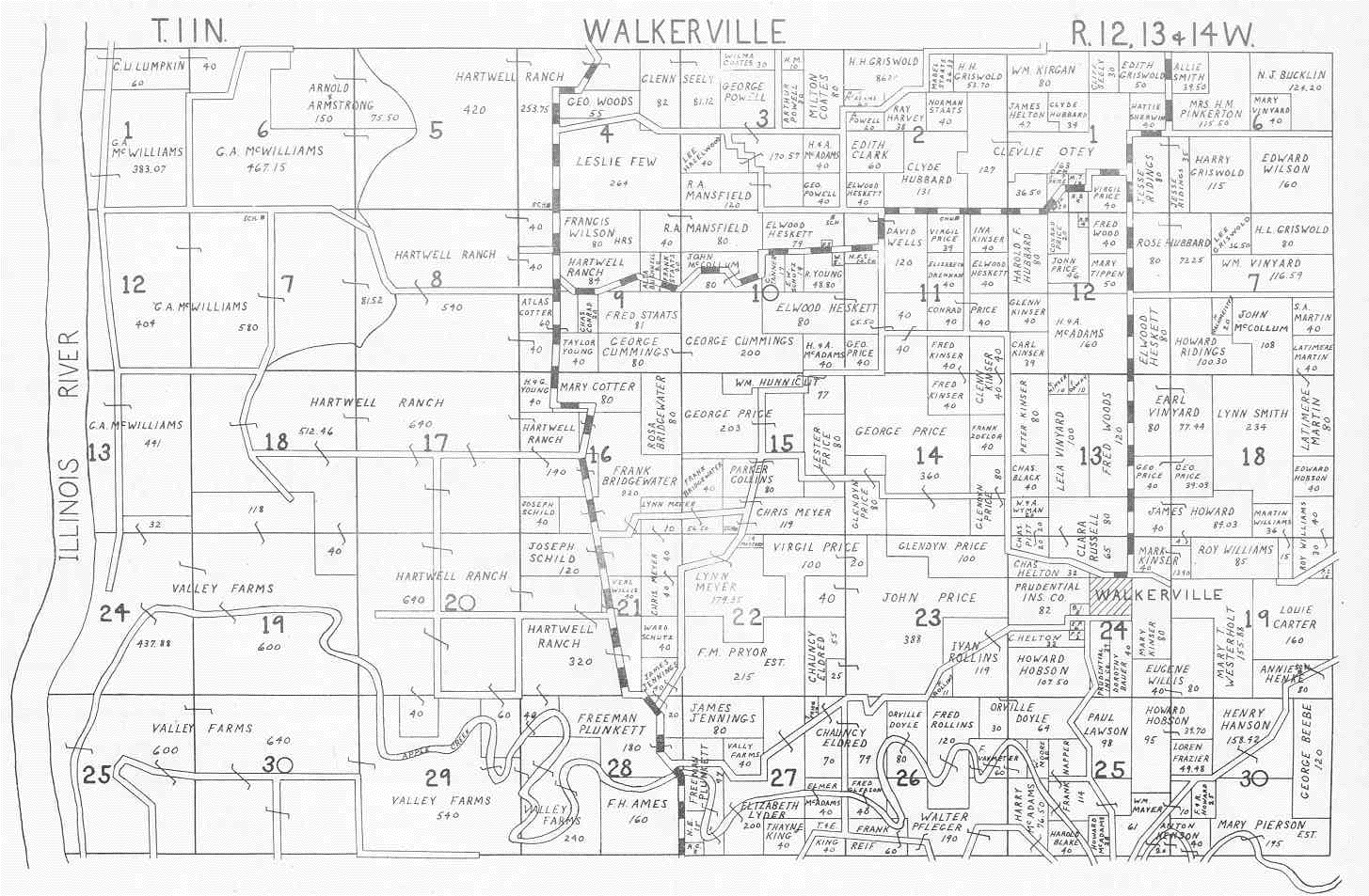 |
Walkerville | |
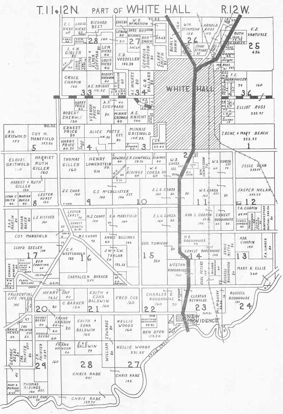 |
Whitehall | |
|
|
Woodville - Part I | |
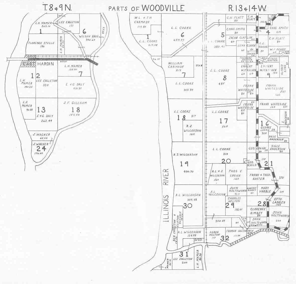 |
Woodville - Part II | |
 |
Wrights |